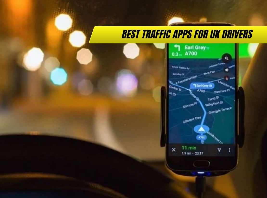
Essential guide to the best traffic apps for UK drivers. Discover which navigation apps excel at avoiding British traffic jams, comparing features, accuracy, and real-world performance.
British roads are becoming increasingly congested, with London ranking among the world’s most traffic-clogged cities and urban centres across the UK experiencing regular gridlock during peak hours. For UK drivers facing daily commutes through Manchester, Birmingham, or Edinburgh, having the right traffic app can transform frustrating journeys into manageable ones.
According to our analysis at AutoHit, the landscape of traffic apps has evolved dramatically, with modern systems using artificial intelligence, crowd-sourced data, and predictive algorithms to stay ahead of congestion. INRIX data shows UK drivers lose an average of 80 hours annually to traffic delays, making effective navigation technology essential rather than optional. We’ve tested the leading traffic apps across Britain’s diverse road network, from M25 congestion to rural Scottish routes, to identify which systems deliver the most reliable real-world performance.
The reality is that no single app excels in every scenario, with different platforms offering unique advantages for specific driving patterns and requirements. Understanding these strengths helps UK drivers choose the optimal combination of apps for their particular routes and vehicle types, whether that’s daily urban commuting, weekend leisure travel, or professional driving across the country.
Key Highlights:
- Real-time Accuracy: Modern apps like Waze and Google Maps use crowd-sourced data from millions of UK drivers to provide accurate traffic updates within 2-3 minutes
- Cost Savings: Effective traffic avoidance can save UK drivers £500+ annually in fuel costs and reduce journey times by 15-25% during peak periods
- Technology Integration: CarPlay and Android Auto compatibility has become essential, with hands-free operation improving safety and convenience
- UK-Specific Features: Apps adapted for British conditions include speed camera databases, congestion charge zone alerts, and motorway service information
- Professional Standards: Commercial drivers rely on TomTom and INRIX for accuracy, while private users favour Google Maps and Waze for convenience
- Offline Capabilities: Backup navigation without data connection proves crucial for rural areas with poor mobile coverage
Google Maps: The Universal Standard
Google Maps remains the default choice for millions of UK drivers, offering comprehensive coverage that extends far beyond basic navigation. The platform’s integration with Google’s search capabilities means finding destinations using partial information works reliably, while real-time traffic data draws from Android devices and other sources to provide accurate congestion information.
The app’s strength lies in its versatility, handling everything from urban navigation through London’s complex street network to rural routes across the Lake District. Multiple route options allow drivers to choose between fastest routes, motorway avoidance, or more economical paths, with clear explanations of why particular routes are recommended.
For UK drivers, Google Maps’ integration with local services proves particularly valuable, showing petrol prices, EV charging stations, and even real-time public transport information for multi-modal journeys. The system’s ability to adapt to changing conditions mid-journey helps navigate around unexpected road closures or accidents that frequently affect British roads.
Advanced Features for UK Conditions
Google Maps’ recent AI-powered improvements include predictive traffic analysis that anticipates congestion based on historical patterns and current conditions. This proves particularly valuable for UK drivers planning journeys around predictable rush hour patterns or weekend leisure traffic.
The Immersive View feature provides 3D visualisation of complex urban intersections, particularly helpful when navigating unfamiliar city centres like Birmingham or Manchester where lane selection matters significantly. Street View integration allows drivers to virtually scout routes beforehand, identifying potential challenges or parking availability.
Integration with calendar apps enables automatic journey time calculations, alerting drivers when they should leave for appointments based on current traffic conditions. This feature proves invaluable for business users who need reliable arrival time estimates for client meetings or important appointments.
Waze: The Community-Driven Champion
Waze has earned a devoted following among UK drivers who prioritise aggressive traffic avoidance over conventional routing. The app’s community-driven approach means real-time reports from other drivers provide immediate alerts about accidents, police activity, road hazards, and construction work across British roads.
The platform’s routing algorithms show particular ruthlessness in finding alternatives to congested main routes, often directing drivers through residential areas or minor roads that conventional sat-navs would avoid. This approach can dramatically reduce journey times during peak congestion but sometimes overwhelms smaller roads with diverted traffic.
Professional drivers across the UK consistently rate Waze as their preferred choice for urban navigation, particularly in London where the app’s ability to navigate around bus lanes, congestion charges, and temporary restrictions provides significant advantages over traditional navigation systems.
Real-World Performance Analysis
Waze excels during unpredictable traffic events – the type of incidents that regularly affect British motorways and urban routes. When the M25 experiences unexpected closures or accidents block major arterial roads, Waze typically provides alternative routes minutes faster than competitors.
The app’s integration with fuel price data helps UK drivers locate cheaper petrol stations, particularly valuable given the significant price variations between urban and rural locations. Speed camera alerts draw from comprehensive databases that cover the extensive network of fixed and average speed cameras across British roads.
However, Waze’s aggressive routing can lead drivers onto inappropriate roads, particularly during severe weather when minor routes become impassable. The app’s tendency to favour any moving road over stationary traffic sometimes conflicts with local knowledge about seasonal flooding or winter conditions common across rural Britain.
TomTom AmiGO: Professional-Grade Accuracy
TomTom AmiGO brings professional-grade navigation technology to consumer smartphones, offering the accuracy and reliability that commercial drivers have trusted for decades. The app’s traffic data incorporates information from millions of vehicles and professional fleet operators, providing particularly reliable information about motorway conditions and major route disruptions.
The platform’s offline mapping capabilities prove crucial for UK drivers venturing into areas with poor mobile coverage, such as the Scottish Highlands or rural Wales. Downloaded maps ensure navigation continues functioning even when data connections become unreliable, providing essential backup for longer journeys.
Speed camera alerts in TomTom AmiGO draw from comprehensive databases that cover the UK’s extensive camera network, including average speed zones that catch many unwary drivers. The system’s accuracy in identifying camera locations and speed limits helps avoid the expensive fines that can significantly impact driving costs.
Electric Vehicle Integration
TomTom AmiGO’s EV-specific features address the growing number of electric vehicles on UK roads, with charging station databases that include real-time availability information and route planning that accounts for battery range limitations.
The app calculates optimal charging stops for longer journeys, considering factors like charging speed, location convenience, and network compatibility. This capability proves particularly valuable for UK EV drivers planning trips between major cities where charging infrastructure varies significantly.
Vehicle-specific routing considers factors like weight restrictions, height limitations, and environmental zones that affect different vehicle types. This feature benefits drivers of larger vehicles or commercial operations who need to avoid roads unsuitable for their specific requirements.
INRIX Traffic: The Data Specialist
INRIX Traffic focuses specifically on traffic information rather than general navigation, providing detailed congestion analysis that helps drivers understand patterns and plan journeys more effectively. The app’s strength lies in its comprehensive data coverage and predictive capabilities that anticipate traffic development over time.
The platform’s historical traffic analysis helps UK drivers understand typical congestion patterns for regular routes, enabling better departure time planning for daily commutes or frequent business journeys. This data-driven approach proves particularly valuable for professional drivers who need reliable journey time estimates.
INRIX’s integration with parking information provides real-time availability data for urban centres, helping drivers locate spaces before reaching destinations. This feature proves particularly valuable in busy city centres where parking scarcity can significantly extend journey times and costs.
Commercial Applications
Professional drivers and fleet operators often choose INRIX for its reliability and comprehensive coverage of UK road networks. The platform’s data feeds into many commercial navigation systems, providing the underlying traffic information that powers various business applications.
The app’s route comparison features allow drivers to evaluate multiple alternatives before departing, considering factors like distance, time, and traffic probability. This analytical approach helps optimise journey planning for businesses where time efficiency directly impacts profitability.
Advanced traffic prediction capabilities help anticipate congestion development, particularly valuable during major events or seasonal traffic patterns that regularly affect British roads. Understanding these patterns helps drivers avoid predictable delays through better timing and route selection.
Apple Maps: The iOS Integration Leader
Apple Maps has evolved significantly since its problematic launch, now offering competitive navigation with particular strengths in iOS integration and user interface design. For iPhone users, the seamless integration with other Apple services creates a cohesive experience that many find preferable to third-party alternatives.
The app’s Look Around feature provides street-level imagery similar to Google Street View, helping UK drivers identify destinations and assess parking availability before arrival. This proves particularly valuable when visiting unfamiliar locations or navigating complex urban environments.
Siri integration enables hands-free operation that exceeds most competitors’ voice control capabilities, allowing drivers to maintain focus on road conditions while accessing navigation information. This safety advantage becomes particularly important during challenging driving conditions common across Britain.
Privacy and Data Handling
Apple Maps’ privacy-focused approach appeals to drivers concerned about data collection and location tracking. The app’s differential privacy techniques provide navigation services while limiting personal information sharing, addressing growing concerns about digital privacy.
The platform’s offline capabilities work automatically, caching map data for frequently travelled routes without requiring manual downloads. This background functionality ensures navigation continues working during data connectivity issues that can affect rural areas across the UK.
Integration with Apple’s ecosystem enables features like automatic route sharing with family members and coordination with other Apple devices. This integration proves valuable for families managing multiple journeys or business users coordinating travel schedules.
Specialist Apps for Specific Needs
Several specialist applications address particular requirements that general navigation apps don’t fully meet. Speed camera apps like Radarbot provide comprehensive coverage of the UK’s extensive camera network, including mobile locations and temporary installations that catch many drivers.
Truck-specific navigation apps like CoPilot GPS address the unique requirements of commercial vehicles, considering weight restrictions, bridge heights, and hazardous material regulations that affect larger vehicles. These specialist solutions prove essential for professional drivers operating commercial vehicles across Britain.
Motorcycle navigation apps offer weather-resistant interfaces and route preferences that favour interesting roads over purely efficient paths. These apps understand that motorcycle riders often prioritise scenic routes and road surface quality over simple time or distance optimisation.
Fuel and EV Charging Apps
Dedicated fuel price comparison apps help UK drivers locate the cheapest petrol stations, particularly valuable given significant price variations between different areas and brands. Apps like PetrolPrices.com provide real-time pricing data that can save substantial money over time.
EV charging apps like Zap-Map have become essential for electric vehicle drivers, providing comprehensive charging point databases with real-time availability, pricing, and user reviews. The rapid expansion of charging infrastructure makes these specialist apps increasingly important for UK EV adoption.
Journey planning apps that combine multiple transport modes help UK drivers optimise complex journeys that might involve driving to park-and-ride facilities or rail stations. These apps prove particularly valuable for commuters in areas where public transport integration can reduce overall journey costs and time.
| App | Strengths | Weaknesses | Best For | UK Features | Our Take |
|---|---|---|---|---|---|
| Google Maps | Universal coverage, search integration | Heavy data usage | Most drivers | Congestion charge zones | The reliable all-rounder |
| Waze | Aggressive traffic avoidance | Sometimes inappropriate routes | Urban commuting | Speed camera alerts | Best for beating traffic |
| TomTom AmiGO | Professional accuracy, offline maps | Limited CarPlay support | Long-distance drivers | Comprehensive speed cameras | Quality without the cost |
| INRIX Traffic | Detailed traffic analysis | Limited general navigation | Data-focused users | Parking integration | Perfect for professionals |
| Apple Maps | iOS integration, privacy focus | iPhone/iPad only | Apple users | Siri voice control | Seamless for iOS ecosystem |
Choosing the Right Combination
Most experienced UK drivers use multiple apps rather than relying on a single solution, with different platforms excelling in different scenarios. A typical combination might include Google Maps for general navigation, Waze for traffic-heavy urban routes, and a specialist speed camera app for comprehensive safety coverage.
The choice often depends on vehicle type, journey patterns, and personal priorities. Daily commuters benefit from apps that learn routine patterns and provide predictive departure timing, while occasional drivers might prefer simpler interfaces with reliable basic functionality.
Professional drivers typically choose accuracy and reliability over convenience features, often favouring TomTom or INRIX solutions that provide consistent performance across diverse conditions. Private drivers might prioritise integration with smartphones and other devices for seamless user experience.
Integration with Vehicle Systems
Modern vehicles’ built-in navigation systems often lag behind smartphone apps in terms of traffic data currency and route optimisation. However, they provide advantages in screen size, voice control integration, and reduced battery drain that make them preferable for longer journeys.
CarPlay and Android Auto integration bridges this gap, allowing smartphone apps to display through vehicle infotainment systems while maintaining the benefits of current traffic data and frequent updates. This integration has become increasingly important for UK drivers who want both convenience and accuracy.
The trend toward connected vehicles means future integration will likely improve, with car manufacturers partnering with app developers to provide seamless navigation experiences that combine the best of both approaches.
Real-World Testing Across UK Conditions
Extensive testing across diverse UK driving conditions reveals significant differences in app performance depending on location and circumstances. Urban areas with dense data coverage generally provide excellent accuracy from all major platforms, while rural areas show more variation in reliability and route suggestions.
Motorway navigation typically favours apps with strong traffic prediction capabilities, as alternative routes often involve significant detours that may not provide time savings. Urban navigation benefits from community-driven apps that can navigate around bus lanes, roadworks, and temporary restrictions common in British cities.
Weather conditions significantly impact navigation app performance, with systems struggling to account for the reduced speeds and route changes that accompany British winter weather. Apps that integrate weather data into routing decisions provide advantages during challenging seasonal conditions.
Peak vs Off-Peak Performance
Traffic apps show dramatic performance differences between peak and off-peak periods, with crowd-sourced systems like Waze excelling during busy periods when user reports provide comprehensive coverage. During quiet periods, these same apps may lack sufficient data to provide optimal routing suggestions.
Traditional navigation systems often perform better during off-peak periods when traffic data becomes less critical and route efficiency depends more on road network knowledge than real-time conditions. Understanding these patterns helps drivers choose appropriate apps for different journey types.
Weekend leisure traffic presents unique challenges, with popular destinations creating congestion patterns that differ significantly from weekday commuting. Apps that understand these patterns provide better route suggestions for recreational driving across Britain’s tourist areas.
Future Developments and Emerging Technologies
Navigation technology continues evolving rapidly, with artificial intelligence and machine learning improving prediction accuracy and route optimisation. Future systems will likely provide even more personalised routing based on individual driving patterns and preferences.
Integration with connected vehicle technologies promises to provide more accurate traffic data and enable cooperative routing that optimises traffic flow across entire road networks. These developments could significantly reduce congestion through better coordination between individual journeys.
Autonomous vehicle development will fundamentally change navigation requirements, though this transition will happen gradually and UK drivers will continue relying on traditional navigation apps for the foreseeable future. Current app development focuses on improving human driver experiences rather than preparing for autonomous systems.
Frequently Asked Questions
Which traffic app is most accurate for avoiding congestion on UK motorways?
For motorway traffic avoidance, Waze typically provides the most aggressive routing around congestion, while TomTom AmiGO offers more conservative but reliable alternatives. Google Maps provides a good balance between accuracy and route appropriateness. Professional drivers often prefer TomTom for its consistent accuracy, while Waze excels during unexpected incidents like accidents or roadworks that frequently affect British motorways.
Do traffic apps work reliably in rural areas with poor mobile coverage?
Coverage varies significantly across apps. TomTom AmiGO and Apple Maps offer the best offline capabilities, downloading maps automatically for areas you visit regularly. Google Maps requires manual offline map downloads, while Waze struggles without data connection. For rural driving across Scotland, Wales, or northern England, apps with strong offline functionality are essential as mobile coverage remains patchy in many areas.
How much mobile data do traffic apps actually use during typical UK commutes?
Data usage varies considerably: Waze typically uses 100-200MB monthly for regular commuting, Google Maps around 50-100MB, while TomTom AmiGO uses less due to offline maps. Apps with live traffic updates consume more data, particularly in congested areas where route updates happen frequently. Most UK mobile plans easily accommodate navigation app usage, but heavy users should consider unlimited data plans.
Can I use multiple traffic apps simultaneously without conflicts?
Yes, many UK drivers run multiple apps concurrently – typically using one for primary navigation and another for traffic monitoring or speed camera alerts. However, this approach drains battery quickly and can create screen clutter. A popular combination is Google Maps or TomTom for navigation with a dedicated speed camera app running in the background for comprehensive safety coverage.
Which apps are best for avoiding London’s congestion charge and ULEZ zones?
Google Maps and Waze both include congestion charge and ULEZ zone information, with Google Maps providing clearer visual boundaries. TomTom AmiGO also supports these zones, while specialist London apps like Citymapper excel for complex central London routing. The key is ensuring your app’s database is current, as these zones expand regularly and staying informed prevents expensive penalty charges.
How accurate are speed camera alerts in UK traffic apps?
Accuracy varies significantly: TomTom generally provides the most comprehensive coverage including mobile camera locations, while Waze relies on user reports which can be excellent in busy areas but patchy elsewhere. Google Maps includes basic fixed camera alerts but isn’t comprehensive. Many UK drivers supplement their main navigation app with dedicated speed camera apps like Radarbot for complete coverage.
Do traffic apps account for seasonal variations in UK driving conditions?
Most apps incorporate historical traffic patterns that reflect seasonal variations like summer holiday traffic or Christmas shopping congestion. However, they’re less effective at predicting weather-related disruptions common in Britain. Apps don’t automatically adjust for reduced speeds during rain, snow, or fog, though some systems are beginning to integrate weather data into routing decisions for more realistic journey time estimates.
Conclusion
The choice of traffic app can significantly impact your driving experience across Britain’s increasingly congested road network. While no single platform excels in every scenario, understanding each app’s strengths helps UK drivers optimise their navigation strategy for different journey types and conditions.
Google Maps provides the most comprehensive all-round solution for occasional drivers, combining reliable navigation with excellent search integration and multi-modal transport options. Waze remains the champion for aggressive traffic avoidance, particularly valuable for regular commuters facing predictable congestion on urban routes and motorways.
For drivers prioritising accuracy and reliability over convenience features, TomTom AmiGO delivers professional-grade performance with offline capabilities that prove essential for UK driving conditions. The app’s comprehensive speed camera database and EV integration address specific needs that many drivers find increasingly important.
The key insight from extensive UK testing is that most effective navigation strategies involve using multiple apps rather than relying entirely on one platform. Whether you’re navigating urban congestion in a family SUV or planning efficient routes in a hybrid vehicle, combining complementary apps provides the most comprehensive traffic management solution.
Looking ahead, navigation technology will continue evolving with artificial intelligence and connected vehicle integration promising even better traffic prediction and route optimisation. However, current apps already provide sophisticated tools that can save UK drivers significant time and money when used effectively. The investment in learning these systems pays dividends through reduced journey times, lower fuel costs, and decreased stress during Britain’s challenging traffic conditions.
Essential guide to the best traffic apps for UK drivers. Discover which navigation apps excel at avoiding British traffic jams, comparing features, accuracy, and real-world performance.